Crash Detection and Reconstruction

Accident Detection & Verification

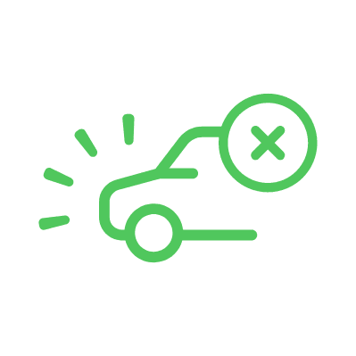
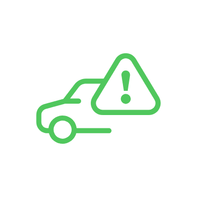
Detect potential crash events using smartphone sensor data and reconstruct what happened with detailed post-trip analysis. The SDK provides the data needed to identify collisions and build a complete picture of the incident, giving claims teams, fleet managers, and safety platforms precise coordinates and a full driving record to work with.

50+

Data Points per Crash Event

3.2B+

Trips Training the Models

GPS

Precise Impact Location

Full Trip

Pre-Crash Record Retained

Key Capabilities

How the SDK captures, classifies, and reconstructs crash events from smartphone sensor data.

Crash Event Detection

The SDK monitors accelerometer, gyroscope, and GPS data throughout every trip. When sensor readings match crash signatures — sudden deceleration, high G-forces, impact patterns — the system flags a potential crash event for verification and analysis.

The detection model is trained on billions of real-world trips to reduce false positives from speed bumps, potholes, or phone drops. However, the real value is in what comes after detection: a detailed reconstruction of the event using the full sensor and location record.

50+

Sensor Data Points Captured

3.2B+

Trips Training the Models

Crash Data Reconstruction

Every flagged crash event comes with a comprehensive data package: estimated speed at the moment of impact, direction and magnitude of force, G-force readings, precise GPS coordinates from live tracking, and a complete timeline of sensor readings before, during, and after the event.

This reconstruction data is designed for post-incident analysis — insurance adjusters investigating a claim, fleet safety teams reviewing an incident, or legal professionals establishing the facts of a collision. The data is objective, timestamped, and captured automatically without any driver input.

50+

Data Points

<1min

Report Generation

Crash Event Data and Integration

Post-crash data and analysis capabilities for claims, fleet safety, and legal teams.

Precise Impact Location via Live Tracking

Live tracking data from the SDK provides the driver’s continuous GPS trace throughout the trip. When a crash event is detected, the exact location is captured with high precision — not an approximate cell-tower position, but a GPS coordinate from the smartphone itself.

This precise location data is critical for post-incident response: dispatching roadside assistance to the right spot, documenting the accident scene for claims, or establishing where the collision occurred relative to intersections, speed zones, or restricted areas. Location data is available immediately through the API alongside the crash event payload.

GPS

Precise Impact Coordinates

Continuous

Live Tracking Trace

Complete Pre- and Post-Crash Trip Record

The SDK retains the full trip record surrounding a crash event: speed profile, behavioral metrics (braking, acceleration, cornering, phone use), risk events, and the complete GPS trace leading up to and following the impact.

This creates a forensic-quality evidence package for post-incident analysis. Claims adjusters can see exactly what the driver was doing in the minutes before the crash. Fleet safety teams can identify contributing behaviors. Legal teams get objective, sensor-verified data that does not rely on driver testimony. All data is structured, timestamped, and exportable via the API.

Full Trip

Pre-Crash Data Retained

Timestamped

Event Evidence

Real-World Applications

How organizations use crash detection and reconstruction data from the Damoov SDK.

Insurance Claims Processing

Automate First Notice of Loss (FNOL) with objective crash data captured at the moment of impact. Adjusters receive a full reconstruction — speed, G-force, location, direction of impact, and the pre-crash driving record — reducing investigation time and enabling faster, more accurate settlements.

Crash reconstruction data also strengthens fraud detection by providing sensor-verified evidence of whether an impact actually occurred, its severity, and the driving behavior that preceded it.

Fleet Incident Review

When a crash event is flagged, fleet operators receive the incident data through the API — including GPS location, impact severity, and the full pre-crash trip record. This enables structured post-incident reviews and safety investigations.

Over time, crash reconstruction data helps fleet safety teams identify patterns: which routes, conditions, or driver behaviors are associated with incidents, and where to focus preventive measures.

Roadside Assistance Dispatch

Crash event data includes the precise GPS location from live tracking, giving roadside assistance providers the exact coordinates they need to dispatch the right resources. No reliance on the driver to describe their location — which matters most when the driver may be disoriented or unable to communicate.

For applications with roadside assistance partnerships, the SDK’s crash event and location data can serve as the automated trigger for dispatch workflows.

Family and Emergency Contact Alerts

When a crash is detected, your app can notify designated family members or emergency contacts with the driver’s precise GPS location and the severity classification of the event. Especially valuable for parental control apps, teen driver programs, and elder care platforms.

Severity classification helps contacts assess urgency — a low-severity event generates an informational alert, while a high-severity impact can trigger an immediate call or emergency workflow.

Legal Evidence Collection

Crash reconstruction data from the SDK provides objective, sensor-verified evidence for accident liability determination: speed at impact, G-force readings, direction of force, GPS coordinates, and a complete pre-crash driving behavior record.

This data is timestamped, structured, and exportable in standard formats — giving legal teams and accident investigators a factual reconstruction that does not depend on driver testimony or eyewitness accounts. Particularly valuable in disputed liability cases.

Ride-Hailing and Mobility Safety

Mobility platforms can integrate crash detection to document incidents involving their drivers and passengers. When a crash is flagged during an active ride, the platform receives location, severity, and the full trip record — providing objective documentation for incident review and liability protection.

Crash reconstruction data helps ride-hailing companies resolve disputes faster and demonstrate due diligence in safety to regulators and insurance partners.

Why Mobile Telematics?

Scale Globally Without Hardware

No devices to ship, no SIM cards to manage, no import logistics to navigate. Mobile telematics turns any smartphone into a powerful sensor — ready to collect high-quality driving data from day one, anywhere in the world.

Up to 70% Lower Cost Than OBD

Eliminate device procurement, installation, cellular plans, and ongoing hardware maintenance. Mobile telematics is a pure software model — no physical inventory, no replacement cycles, and dramatically lower total cost of ownership compared to on-board diagnostics (OBD) or GPS trackers.

Configure and Update in Hours

Forget firmware rollouts and device recalls. With mobile telematics, configuration changes and model updates go live in hours, not months — across your entire user base. And because modern smartphones pack powerful processors and advanced sensor arrays, you can run sophisticated algorithms on-device that no dedicated hardware tracker can match.

Connects to the Systems You Use Now

Stream telematics data into your fleet management, insurance, or mobility platform through well-documented APIs. No middleware, no custom connectors — just clean integration that fits your existing technology stack.

Get Started

Tell us about your use case and we will recommend the right integration path for your team.

By submitting this form, you agree to our Privacy Policy and Terms of Service.

Solutions Across Mobility Industries

Purpose-built telematics capabilities for fleet, insurance, mobility, and education verticals.

🚛

Fleet Management

Real-time location monitoring, driver safety scoring, and fleet-wide performance analytics.

📦

Logistics & Delivery

Trip logging, driver behavior monitoring, and real-time speed and location tracking for every delivery.

🚕

Mobility Platforms

Driver performance metrics, trip-level behavior analysis, and live location tracking for ride and mobility services.

🛡️

Insurance

Driving behavior data for usage-based insurance, risk scoring, and claims evidence.

🎓

Driving Schools

Student driving behavior assessment, lesson-by-lesson safety scoring, and progress tracking.

🚌

School Transport

Real-time vehicle tracking, driver safety monitoring, and trip visibility for parents and administrators.

🔑

Carsharing & Rentals

Vehicle location tracking, trip logs, and driver behavior monitoring for shared and rental fleets.

Ready to Reduce Driver Risk?

Talk to our team about integrating Safety Score into your platform.